Nederlands
  Français
  Deutsch
  Italiano
  Español
  Português
City Center (Canal Belt and Jordaan)
Location: The historic core of Amsterdam, roughly bounded by Central Station, the Singelgracht, and the Amstel River.The city center is the oldest and most compact part of Amsterdam. It includes the UNESCO-listed canal belt (Grachtengordel), the Jordaan, and several smaller historic quarters. This area shapes the global image of Amsterdam while still functioning as a living urban center with residents, offices, shops, and institutions.
Historical context
The canal belt was built in the 17th century during the Dutch Golden Age as a planned expansion for wealthy merchants and city regents. Broad canals and large houses created an orderly and prestigious district.At the same time, the Jordaan developed as a working-class neighborhood. Its narrow streets and dense housing reflected the more practical needs of craftsmen and laborers. Over the centuries the entire area grew into the administrative, commercial, and cultural heart of the city.
What you find here today
Canal Belt (Grachtengordel)The canal belt remains one of the best preserved historic urban landscapes in Europe. Elegant canal houses line the Herengracht, Keizersgracht, and Prinsengracht. Many buildings are still used as private homes, while others contain offices, museums, and boutique hotels.
Jordaan
The Jordaan contrasts with the formal canal belt. Its small streets, former workers’ houses, and intimate squares create a village-like atmosphere despite the central location. Independent shops, cafés, galleries, and local markets dominate the area.
Additional attractions
The Nine Streets form a compact shopping district with independent fashion and design stores. Canal cruises pass through the UNESCO-listed canals and are especially scenic in the evening. The Houseboat Museum offers a view inside a traditional canal houseboat, while historic merchant mansions occasionally open their interiors for exhibitions and guided tours. Several bridges also provide famous viewpoints, including the Reguliersgracht perspective known as the “Seven Bridges” view.
Character of the area
The city center is architecturally dense and highly walkable. Streets are lively throughout the day, although major attractions can become crowded. The area combines high-end housing, tourism, and everyday city life, making it both a global destination and a functioning residential district.Jewish Area (Jodenbuurt)
Location: Eastern side of the historic center, roughly around Waterlooplein, Nieuwe Herengracht, Jonas Daniël Meijerplein, and Plantage Middenlaan.The Jewish area, often called the Jodenbuurt, is not an official administrative neighborhood but a historic district with a strong cultural identity. From the 16th century onward it became the center of Jewish life in Amsterdam.
Historical context
The district was first settled by Sephardic Jews who arrived from Portugal and Spain. Later, Ashkenazi Jews from Central and Eastern Europe joined the community. By the early 20th century the area had developed into a dense working-class neighborhood filled with markets, workshops, small synagogues, and community institutions.During the Second World War almost the entire Jewish population was deported. After the war the district remained largely empty, and many original buildings were demolished in the decades that followed.
What you find here today
Today the area is calm and spacious, with several museums and memorial sites.The Jewish Cultural Quarter forms the historical center of the district. It includes the Jewish Museum, the Portuguese Synagogue from 1675, and the Hollandsche Schouwburg memorial.
Nearby Waterlooplein hosts one of Amsterdam’s oldest flea markets, surrounded by canals and bridges. The district gradually merges into the Plantage area, a greener part of the center that contains theatres, museums, and the Artis zoo. The canals Nieuwe Herengracht and Nieuwe Keizersgracht also show a more elegant architectural side of the historic quarter.
Character of the area
The Jewish area feels quieter than most of the city center. Streets are easy to walk, and the architecture varies from historic canal houses to later modern buildings. Cultural institutions and residential buildings stand alongside small businesses.Compared with other central districts, nightlife and tourist crowds are limited. Visitors often come here for museums, historical context, and calmer streets while still remaining close to the heart of Amsterdam.
Amsterdam Noord
Location: Directly across the IJ waterway from Central Station. Accessible by free ferries, the Noord/Zuid metro line (Noord station), and road or cycling tunnels.Amsterdam Noord was long seen as a separate industrial area. Over the past 15 to 20 years it has developed into one of the city’s most dynamic districts, combining new housing, creative industries, and waterfront redevelopment. The district remains diverse, with residential zones, industrial remnants, and experimental cultural spaces. Food venues, festivals, and nightlife have expanded rapidly, particularly around NDSM and the waterfront areas.
Many visitors come for the views across the IJ, which provide some of the best panoramas of the historic skyline. Cultural landmarks near the ferry landing include the A’DAM Tower, the Eye Filmmuseum, and Tolhuistuin. The district also attracts residents seeking larger apartments and more space than the inner city offers.
Origins and development
Historically, Noord was dominated by shipyards, warehouses, and workers’ housing. Because it lay across the water, many residents of Amsterdam rarely visited the area.Large redevelopment projects since the early 2000s have transformed former industrial sites into arts districts, office hubs, and modern residential neighborhoods.
Key areas in Noord
NDSM WerfThe NDSM Wharf occupies a former shipyard that now hosts studios, creative companies, festivals, and large cultural events. Street art, temporary structures, and reused industrial buildings give the area a distinctive atmosphere.
Buikslotermeer and Noord Station
Around the metro terminus a new urban center has developed with modern apartment buildings, shopping streets, and wide boulevards.
Vogelbuurt and Floradorp
These neighborhoods represent older parts of Noord. Brick row houses, quiet streets, and a strong local community give them a traditional residential character.
Nieuwendammerdijk and Schellingwoude
Historic dike villages along the northern edge of the district offer a completely different atmosphere. Wooden houses, old farms, and narrow roads create a setting that feels almost rural compared with the rest of Amsterdam.
Character of Noord
Amsterdam Noord feels more spacious and experimental than most other districts. Modern architecture stands next to industrial remains and older residential streets. The population is relatively young, with many newcomers drawn by new housing and creative industries.Compared with the historic canal belt, Noord feels less formal and more open, giving the impression of a different city across the water.
Amsterdam Zuid
Location: South of the city center, stretching from De Pijp to the Zuidas business district.Amsterdam Zuid combines affluent residential neighborhoods, major cultural institutions, and the city’s main financial center. It is one of the most economically significant parts of Amsterdam.
Origins and development
Most of Amsterdam Zuid was developed in the late 19th and early 20th centuries as a spacious alternative to the crowded historic center. City planners designed wide streets, generous green spaces, and higher-quality housing.In later decades the district expanded further south with the development of Zuidas, which introduced a major concentration of offices and international businesses.
Key areas in Zuid
De PijpDe Pijp is a dense and lively neighborhood with a strong local character. The Albert Cuyp Market forms the central commercial spine, surrounded by cafés, bars, and everyday shops. Students, young professionals, and expats are strongly represented among the residents.
Museum Quarter
The Museum Quarter is defined by large cultural institutions and open green spaces. Several of Amsterdam’s most important museums stand here, and the district borders the northern edge of Vondelpark. The atmosphere is more cultural and institutional than residential.
Oud-Zuid
Oud-Zuid is one of the city’s most affluent residential areas. Large townhouses, quiet streets, and proximity to Vondelpark create a calm environment that has long attracted upper-middle-class households.
Zuidas
Zuidas functions as Amsterdam’s main business district. Modern office towers house banks, law firms, and multinational companies. In recent years residential development has increased, gradually creating a more mixed urban environment.
Character of the area
Amsterdam Zuid is more structured and spacious than the city center. Quiet residential streets exist alongside dense business activity around Zuidas. This combination of professional life and upscale housing defines the district.Amsterdam West
Location: West of the city center, roughly between the Singelgracht and the A10 ring road.Amsterdam West is a diverse district made up of early 20th-century neighborhoods and newer waterfront developments. It is largely residential but remains closely connected to the historic center.
Origins and development
Most of the district was built between 1900 and 1940 as the city expanded outward. Architecture from the Amsterdam School movement is visible throughout the area, with expressive brickwork and carefully planned street layouts.Originally home to working- and middle-class residents, West has gradually become socially mixed as redevelopment and gentrification have changed parts of the district.
Key areas in West
Oud-WestOud-West lies closest to the city center and has a lively atmosphere. Residents value the central location without the intense tourist activity of the historic core. Local cafés, food halls, and shopping streets shape daily life.
De Baarsjes
De Baarsjes consists mainly of residential streets lined with characteristic brick apartment blocks. Over the past two decades the neighborhood has changed rapidly while maintaining a strong cultural mix and active local businesses.
Bos en Lommer
Bos en Lommer offers more space and generally lower housing costs than Oud-West. The neighborhood combines post-war housing with newer developments and maintains a strong community focus.
Houthavens
Houthavens is a redeveloped harbor area that now forms a modern waterfront residential district. Contemporary architecture and newly planned public spaces give the neighborhood a distinctly modern character.
Character of the area
Amsterdam West is residential, socially mixed, and steadily evolving. Compared with the city center it is less oriented toward tourism and more focused on everyday neighborhood life.Amsterdam Oost
Location: East of the city center, extending from the Amstel to Watergraafsmeer.Amsterdam Oost is socially and architecturally varied. Historic working-class neighborhoods, multicultural districts, and modern waterfront developments exist side by side.
Origins and development
The district developed in stages beginning in the late 19th century. Early industrial zones and workers’ housing were followed by more suburban residential areas. After the Second World War the district expanded further, adding new housing and infrastructure.Key areas in Oost
Indische Buurt and DapperbuurtThese dense neighborhoods are strongly oriented toward everyday life. Dappermarkt, one of Amsterdam’s largest street markets, forms a central hub. Over recent decades regeneration projects have improved housing and public space while maintaining the area’s practical character.
Eastern Docklands
The Eastern Docklands were once port facilities. They have been transformed into modern residential districts with contemporary architecture, waterfront housing, and carefully planned public spaces.
Watergraafsmeer
Watergraafsmeer was originally a drained polder that later became part of the city. The area is greener and more spacious than much of inner Amsterdam and includes several parks and sports facilities. Families are strongly represented among residents.
Character of the area
Amsterdam Oost combines dense urban neighborhoods with newer, more spacious developments. Tourism plays a smaller role here, and the district maintains a strong local orientation.Amsterdam Zuidoost
Location: Southeast of the city, beyond the Amstel and the A10 ring road.Amsterdam Zuidoost is the youngest and most spacious district of the city. It was largely developed after the Second World War and follows a very different urban design than the historic center.
Origins and development
Most of the district was built in the 1960s and 1970s. The Bijlmer project introduced large-scale modernist housing with separated traffic systems, elevated roads, and extensive green space.From the 1990s onward large redevelopment programs reshaped the area. Housing was renovated or replaced, and public space was redesigned to create a more varied urban environment.
Key areas in Zuidoost
BijlmerThe Bijlmer features large apartment complexes surrounded by open green areas and wide roads. It has one of the most multicultural populations in Amsterdam. Ongoing redevelopment has introduced a wider mix of housing types.
Arena Area
The Arena Area forms a major entertainment and commercial zone. Stadiums, concert venues, offices, and large shopping centers attract heavy foot traffic during events.
Parks and green zones
Large parks and recreational areas provide significantly more open space than in most other districts of the city. These areas are widely used for sports and outdoor activities.
Character of the area
Amsterdam Zuidoost is defined by space, scale, and diversity. The district feels less dense than inner Amsterdam and reflects modern urban planning rather than historic street patterns.Amsterdam’s Diversity in Two Snapshots
The Jewish area and Amsterdam Noord illustrate how much contrast exists within one city. The Jewish district is a compact historic quarter shaped by centuries of cultural life and historical loss. Amsterdam Noord, by contrast, is a wide and evolving district defined by redevelopment, experimentation, and open space.Together they show how Amsterdam combines old and new environments within a small geographical area. Neighborhoods sit close together on the map but differ strongly in architecture, history, and daily life. As visitors move through the city, this pattern repeats across districts, giving Amsterdam its layered and diverse character.
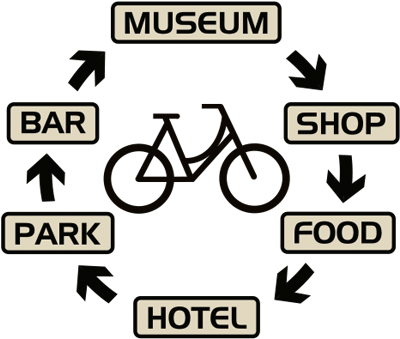
Use a bike your entire stay